Jean-Luc Demaret G
« A perfect family day on the Semois. The welcome at Kayak Belgique is warm, the equipment is spotless (the kayaks are modern and clean), and the free shuttle system is superbly organised. A must-visit in the Ardennes! »
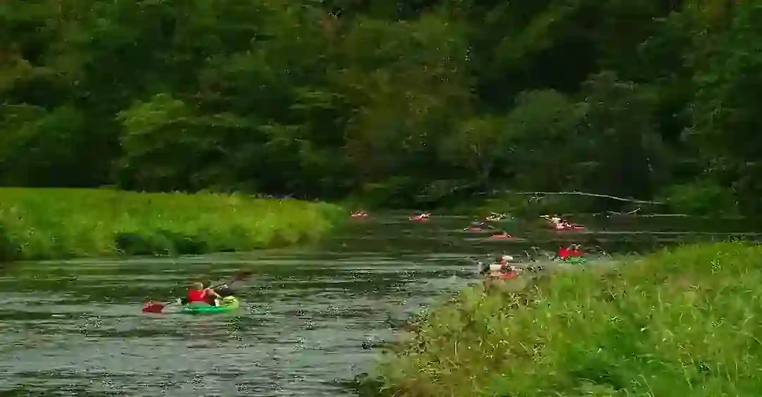
Of all the Ardennes river trips, kayaking down the Semois is the cheapest per kilometer, the most authentic and the calmest. You paddle through the heart of the National Park, you can spot otters and kingfishers, and a free shuttle brings you back.
The Ardennes river that changes everything
The Semois is not an "aquatic highway". A class I river, calm and without rapids, navigable by everyone, flows through the Semois Valley National Park (28,900 ha, recognized in December 2022). On some weekends 3,500 kayaks pile up on the Lesse, whereas on the Semois you can paddle 30 minutes on the Semois without passing another boat.
Its geology gives the Semois its unique character: a substrate of Ardennes schist and Devonian phyllites (impermeable rock) has carved deeply encased meanders, with a complexity rarely seen in Western Europe. Their steep slopes naturally limit urbanization and create microclimates, which explain the rich biodiversity and the water quality.
People have kayaked here since the 1970s, but the National Park, created in December 2022, has radically changed things. Navigation quotas are respected, quiet zones for wildlife are identified, and a responsible kayaker charter is in place. To remain exceptional, the Semois protects itself.
"Choosing this operator means more than renting a kayak: the visitor gains access to a preserved fragment of the Ardennes, in the company of experts who are passionate about their region."
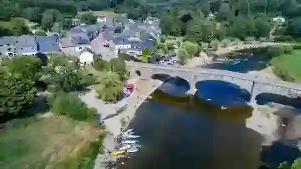
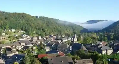
8 moments on the Semois
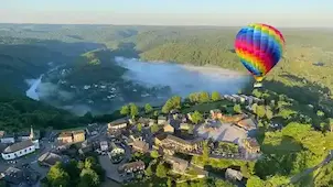
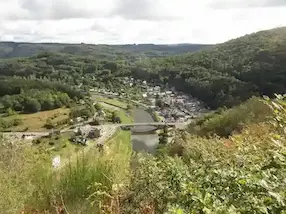
🗺️ Modular architecture · Every profile · Selection quiz available
Routes run from a first family trip (7 km, 1h30, from 3 y/o) to a big sporty day trip, Alle → Bohan (17 km, 6h30). To select your route, use the interactive quiz, which analyzes your level, your group and the duration you want.
| Route | Distance | Profile | Duration |
|---|---|---|---|
| Alle → Vresse-sur-Semois | 7 km | Family · from age 3 | 1h30–2h |
| Poupehan → Alle-sur-Semois | 10 km | Discovery | 2h–3h |
| Alle-sur-Semois → Membre | 11 km | Intermediate · Natura 2000 | 2h30–3h |
| Alle → Bohan-sur-Semois | 17 km | Sporty · Tobacco Route | 4h–5h |
📊 Objective comparison · Verifiable data 2026
The numbers speak for themselves. On every metric that truly matters, the Semois is the most advantageous river in the Belgian Ardennes.
| Indicator | 🏆 Semois – www.kayak-belgique.com | Lesse (Dinant) | Ourthe (Durbuy / La Roche) |
|---|---|---|---|
| Starting price / person | €26.40 – €35.20 | €37 – €43 | €27 – €35 |
| Typical route distance | 16 km | 12 km | 4 – 18 km |
| Cost per kilometer | ~€2.00/km | ~€2.25/km | Up to €6.75/km |
| Navigation duration | 4h – 5h | 2h30 | 1h30 – 3h30 |
| Crowds | Calm · 30 min w/o boats | 3,500 kayaks/day (saturated) | High · urban |
| National Park | ✅ 28,900 ha | ❌ | ❌ |
| Live flow monitoring | ✅ Only one in BE | ❌ | ❌ |
| Free cancellation | ✅ 1 click | Variable | Variable |
| Savings for family of 4 | Up to €36 saved | Reference | — |
Source: comparative analysis of the official websites of Belgian operators · Updated 2026 · Detailed Lesse vs Semois comparison →
🐦 Biodiversity · National Park · Natura 2000
Because a kayak moves slowly, it is the most discreet tool there is for observing wildlife. Since the Semois crosses protected Natura 2000 areas, its biodiversity is exceptional, as long as you navigate calmly and respectfully.
Ciconia nigra – Protected species. Nester in large Ardennes beech forests and schist cliffs. More discreet than the white stork, it can be observed flying low over the river (wingspan 1.85m) or perched at the edge. Best observation: wooded sections between Alle and Membre, June-July (feeding the young).
Alcedo atthis – One of the most spectacular birds in Europe. Its metallic turquoise and orange plumage is unmistakable. Direct indicator of exceptionally high-quality water. Fast, straight flight just above the water, sometimes hovering before a dive. Best observation: sandy banks between Laforêt and Membre, early morning.
Lutra lutra – Confirmed by environmental DNA in 2023 in the Vresse, Mortehan, and Chiny sectors (National Park). Active at dusk and dawn. Swims on the surface with its head visible. Its spraints (feces intentionally deposited on banks) are sometimes visible from the kayak less than 1m from the water. Best chance: Vresse-Membre section, early morning or evening.
Castor fiber – Rapidly expanding population in Wallonia since the 2000s. Its dams made of branches and clay (visible from the kayak on the right bank after Laforêt) and trees gnawed in a characteristic "pencil shape" are signs of its presence. Nocturnal, but visible at dawn near its lodges. Indicator of a healthy river.
Ardea cinerea – The large grey Ardennes wading bird. Motionless on the banks like a statue, or in majestic flight with long dangling legs. Nests in colonies (heronries) in the large oaks on the bank. Visible on all routes, all season long. Easily disturbed — paddle gently when approaching to watch it for a few seconds.
Thymallus thymallus and Salmo trutta – Two species with high indicator value for water quality. The grayling, with its flag-like dorsal fin, is visible in translucent shallows. The brown trout inhabits fast-current sectors. Best observation: clear-bottom sections between Bohan and Membre, low water in July-August. The PNVS is working on identifying local strains.
Cervus elaphus and Sus scrofa – Large forest mammals approach the banks at twilight hours to drink. Best chance: forest sections between Poupehan and Alle (wild section), 6h-8h and 18h-20h. In September-October, rutting deer can be heard long before they are seen — an unforgettable sound in the nocturnal Ardennes forest.
Foxglove (Digitalis purpurea) in summer, wild daffodil (Narcissus pseudonarcissus) in spring (March-April, banks and wet meadows), meadowsweet (Filipendula ulmaria) in July on wetlands. Peak bloom: May-June for a unique multicolored spectacle on the banks of the Ardennes Semois. In autumn, orange beech trees frame the river in a tunnel of colors.
Blooming riverbanks (daffodils, primroses), with black stork and kingfisher nesting. Migratory birds. The flow is still strong but the water clear. Fewer tourists.
Wildlife at its peak (young of the year). The water is warm and clear, and thermal comfort is best in shaded areas (Alle→Membre). Attendance is higher but still moderate compared with the Lesse.
Spectacular beech forest colors and rutting deer (an unforgettable sound). Beavers are highly active (winter building). Fewer crowds, cool and clear water, and exceptional light for photography.
Navigation is generally suspended (flow too high, cold). Check the live monitoring. A few exceptional days are possible in late February.
On the Semois, a Natura 2000 classified site, we make all our kayakers aware of 3 essential rules: (1) Zero waste — use the provided waterproof bucket to bring absolutely everything back; (2) Safety distance — keep at least 30m from cliff nesting zones (black stork, peregrine falcon) and beaver dams; (3) Official landing areas only — no wild landing, to protect the banks and aquatic vegetation. This collective respect is what lets the Semois remain one of the richest rivers in Belgium for wildlife.
📡 Official SPW Data · Station 9434 Membre · Auto update
The Semois is a strictly pluvial regime river: after heavy rains, its flow can triple within just a few hours. We are the only operator in Belgium to offer you a real-time dashboard coupled with a navigability algorithm, so that you never make the trip for nothing.
Current state of the Semois – 09/29/2026 pm30 5:04 PM
Navigation is currently prohibited or ill-advised. Contact us before traveling.
Stay informed: sign up for the email alert, and you will know as soon as navigation resumes.
📡 Station 9434 - Membre 📍
Last Update : 29/09 at 17:00
The SVG graph displays the last 100 readings taken from the Membre station 9434 (SPW). The dotted red line at 50 m³/s is the critical threshold: beyond it, navigation is prohibited whatever the operator. The colored area under the curve uses a blue→yellow→red gradient, which shows the flow intensity at a glance.
The Difficulty Score (0-100) is calculated by our proprietary algorithm, which cross-references several variables at once and not just the flow:
🔔 Never make the trip for nothing
An automatic email reaches you as soon as the navigation status changes.
Raw data from the Public Service of Wallonia (SPW), Membre hydrometric station 9434. Authorities use the same source to trigger flood alerts.
Every 15 minutes. In the event of an exceptional occurrence (flow > 50 m³/s), checks are intensified for maximum responsiveness.
To calculate a 0-100 difficulty score more nuanced than a simple flow threshold, it cross-references flow, water/air temperature, weather conditions and humidity.
An email goes to all booked kayakers as soon as navigation status changes (allowed → prohibited or vice versa). You need take no action.
Source: SPW Wallonia · Station 9434 Membre · State of the Walloon Environment
🏛️ Heritage visible from the kayak
The Semois does not flow through a neutral landscape. At every meander you find an iconic place, a living, classified or exceptional piece of natural heritage.
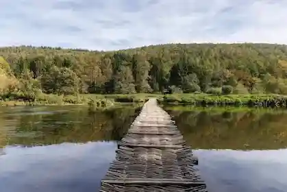
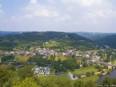
80 meters of ephemeral woven vegetation. Structure made of oak, beech, hornbeam, and hazel — each species chosen for its precise mechanical properties. Built every summer in ~1.5 days by municipal staff. During the July 2021 flood, it split in two without being destroyed: a "millennial intelligence". In Laforêt, disembark for 15 mins to cross it on foot.
🛶 Alle→Vresse (7km)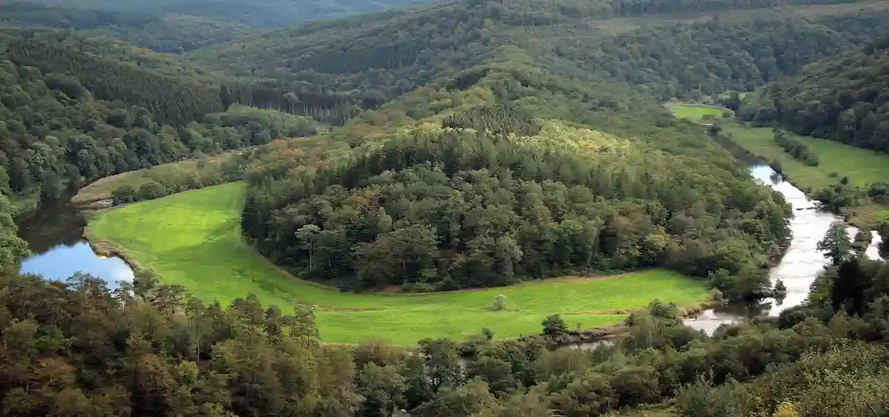
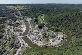
A perfect meander encircling a wooded hill in a horseshoe shape — classified as exceptional Walloon heritage. From the kayak, you navigate inside the loop itself, a visual experience impossible from land viewpoints. Slow down in the meander to catch the hill that seems to "float" in the river.
🛶 Poupehan→Alle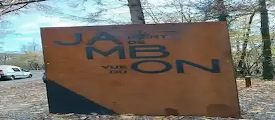
A tight loop between Membre and Bohan, whose shape seen from above evokes an Ardennes ham. In the kayak, you navigate the inside of the "ham", and the right bank going downstream is the most spectacular. For an unforgettable aerial photo, pair it with the terrestrial viewpoint from the nearby belvedere.
🛶 Alle→Bohan (17km)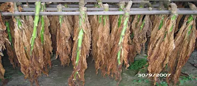
19th-century slatted structures (vertical wooden planks spaced for natural ventilation). Drying shed on rue Fernande Pierard: 10x4.5m. Drying shed on rue de la Grotte: 15x4m. Restored in 2018 as part of the Tobacco Route. Just 200m from the Bohan landing stage, Maison Martin (last active tobacco factory in the Namur province) is open year-round.
🛶 Alle→Bohan (17km)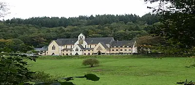
A Cistercian haven of peace nestled in a meander between Bouillon and Poupehan. Founded in the 12th century, it was rebuilt after the destruction of the French Revolution. You see it from the kayak as you exit a meander, its white facade contrasting with the dark forest. The bells chime the hours, a sound of rare sweetness from the water.
🛶 Poupehan→Alle (10km)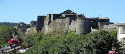
A medieval fortress of the 11th century, built on a rocky spur encircled by the Semois. Godfrey of Bouillon lived here before leaving for the 1st Crusade (1096). It lies upstream of the main routes, yet a trip to Bouillon fits naturally into a kayaking getaway: kayak down the Semois, then visit the castle on foot.
🛶 Bouillon (upstream)📋 Practical Guide · Checklist & Steps
Choose your route (interactive quiz)
Level, group, desired duration: in 3 questions, the quiz on our site guides you to one of the 4 routes. Or take the quiz directly →
Check the water level
Check our live indicator before booking. Ideally it lies between 5 and 30 m³/s. Below 2.2 m³/s some sections are impassable.
Book online (3-5 days in advance)
Secure booking on our site. Free cancellation until departure. Let us know for dogs, young kids, or groups > 10 people.
Arrive at the Vresse-sur-Semois base
Parking is free and changing rooms are available. Arrive 15-20 min before the time given for briefing and gear.
Safety briefing + equipment
A kayak suited to your group, certified jackets, paddles and a waterproof bucket. A 5-minute briefing covers basic paddling, the Responsible Kayaker Charter and stop points.
Outbound shuttle, descent, return shuttle
The shuttle drops you at the start, and you navigate at your own pace. When you arrive, the shuttle takes you back to base, where a terrace or chip shop is available on site.
⭐ 1,282 Google reviews
Our kayakers return year after year. The top 4 points cited in their reviews: the absolute tranquility of the river (as against the saturated Lesse), the warm and passionate welcome from the team, logistics without surprises (everything is truly included, even the waterproof bucket), and the exceptional richness of the wildlife they can observe.
"An incredible trip! The Semois is so much calmer and more beautiful than the Lesse. At €26.40 all-in, you cannot do better in Belgium. At the end of the route we saw a kingfisher, a beaver and even what we think was an otter. The kids were super excited!"
"What a brilliant service, this email alert when the water level changes. We did not even know it existed. The day before rain, we were able to reschedule for free. The kids (4 and 7 y/o) loved the Pont de Claies from the kayak, and you cannot see it this well from the bank."
"Really everything is included, with no surprises: shuttle, life jackets, bucket. The drivers are friendly and super passionate about their region. We did the 17km Alle-Bohan, an unforgettable day in a wild and silent setting. We will absolutely do it again!"
"A very beautiful river, and well supervised. The water level monitoring is a true innovation. On the morning of our arrival we had to adjust our route because of a stronger flow, and the team handled it perfectly. We still did a magnificent 11km."
"We did the 17km Alle-Bohan in slow photography mode. In the Membre meanders, the Semois offers incredible lighting at dusk. We saw 2 grey herons, 1 active beaver and 3 kingfishers. There were absolutely no other kayaks for the last 2 hours. Perfect."
"This is our third consecutive year on the Semois. We began with the 7km with the kids (4 years old at the time), and this year we did the 18km as a family. The river grows with us. The team recognizes us and always adapts the equipment perfectly."
Frequently Asked Questions · Kayak Semois
Here are all the answers you need to prepare your Semois kayak trip in peace.
Rates start at €26.40 per person for the Alle→Vresse route (7 km, 1h30-2h), and go up to €35.20 for the sporty Alle→Bohan (17 km, ~5h). All rates are all-in: free shuttle, certified life jacket, ergonomic paddle, waterproof bucket, parking. No extras. ~€2/km, compared to ~€2.25/km on the Lesse and up to €6.75/km on the Ourthe. View all prices →
4 routes: (1) Alle→Vresse 7km / 1h30-2h (Beginner/Child from 3-4 y/o) ; (2) Poupehan→Alle 10km / 2h30-3h (Panoramic, Frahan) ; (3) Alle→Membre 11km / 3h-3h30 (Intermediate, Natura 2000) ; (4) Alle→Bohan 17km / 4h30-5h (Sporty, Tobacco Route, big day trip). Use our selection quiz to find your ideal route.
Yes, it is the most family-friendly river in the Ardennes. Class I river: calm, no rapids, shallow. The Alle→Vresse route (7 km) is perfect from 3-4 years old. Two-seater kayaks and family boats are available. Certified life jackets in all sizes.
The all-in rate includes: boat rental (single, double, or family), free round-trip shuttle (bus or minibus), certified life jacket, lightweight ergonomic paddle, waterproof hermetic bucket for your valuables, free parking, access to changing rooms. No hidden fees, no surprises.
Kayak Belgique is the only operator in Belgium offering real-time tracking via official SPW data. Our algorithm analyzes the flow (m³/s) by the minute. Ideal flow: 5-30 m³/s. Ban threshold: ~2.2 m³/s. Automated email alert sent if your booking date is affected. Free cancellation in this case. Check the live level on our site.
Yes, dogs are allowed. Let us know when booking so we can provide a suitable kayak (stable two-seater or wide model). A dog life jacket is recommended. The Semois, a calm class I river crossing a National Park, is an ideal setting for animals.
4 objective advantages: (1) Price: ~€2/km vs ~€2.25/km (€36 savings for 4 people); (2) Tranquility: no "3,500 kayaks/day" like on the Lesse — 30 mins without a boat is possible; (3) Duration: 4h-5h vs 2h30 for less money; (4) Authenticity: National Park, Natura 2000, true "Ardennes" scenery. See our detailed comparison →
The Semois crosses protected Natura 2000 areas: black stork (cliff nester), kingfisher (water quality indicator), European otter (eDNA confirmed 2023 in Vresse, Mortehan, Chiny), beaver (dams visible from the water), grey heron, grayling, and brown trout. Slow kayaking navigation is the best possible observation method.
Yes, free 1-click cancellation. If the SPW monitoring issues a navigation ban on your date, you will receive an automatic email alert and can postpone or cancel free of charge — unlike some competing operators with more rigid conditions.
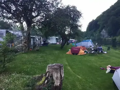
Yes. Several campsites on the banks of the Semois welcome kayakers (tent, caravan, or motorhome), often from around €14/night. You will usually find electrical connections, hot showers, and direct access to the river. Ideal for a "kayak + camping" weekend in the Semois valley.
High season (June-August): best weather conditions, all routes active. Spring (April-May): riverbank blooms, wildlife nesting, less crowded. Autumn (Sept-Oct): spectacular Ardennes colors, calm and often sunny. Avoid days after heavy rains (flow too high) — always check our live indicator.
📖 Dive Deeper · Further Reading
Heritage
Complete Guide 2026: Pont de Claies in Laforêt80m · 4 species · Ancestral technique · 2021 Flood
Guide
Kayaking in Belgium – Complete GuideComparison of all rivers · Semois, Lesse, Ourthe, Amblève
🛶
From €26.40 all-in · Free shuttle · Certified life jackets · Live monitoring unique in Belgium · Free cancellation · 4.6/5 rating · 28,900 ha National Park · Families from 3 y/o
Kayak Belgique · Vresse-sur-Semois (5550) · Namur Province · Belgium
« A perfect family day on the Semois. The welcome at Kayak Belgique is warm, the equipment is spotless (the kayaks are modern and clean), and the free shuttle system is superbly organised. A must-visit in the Ardennes! »
« Beautiful kayak trip on the Semois starting from Vresse! Very friendly staff and excellent shuttle service. The riverside campsites along the Semois are also a must for nature lovers. »
« Superb 11 km kayak descent starting from Alle-sur-Semois. The wild nature of the Ardennes is magnificent in the spring sunshine. Very competitive prices compared to the competition. We'll be back! »
« Wonderful experience! The kayak tour on the Semois was perfectly organised. The team is very helpful and speaks good German. The scenery of the Belgian Ardennes is simply breathtaking. »
« Excellent kayak rental service and great campsite on the banks of the Semois. The prices are very fair and the atmosphere is friendly and family-oriented. The little terrace bar is perfect for a refreshing drink after the effort. »
« A fantastic last-minute welcome even though we hadn't booked in the middle of August. Life jackets and waterproof barrels are provided free of charge. Very safe descents, ideal with children! »
« Top-tier kayak rental on the Semois river. Extremely friendly staff, well-maintained kayaks, and a reliable shuttle. The viewpoints along the river are absolutely stunning. Highly recommend this local business! »